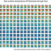
Sea surface temperature maps show warming waters off Tasmania
They say a picture is worth a thousand words. This is certainly the case for a new Redmap poster that maps changes in sea surface temperature off Tasmania over the past 24 years.


They say a picture is worth a thousand words. This is certainly the case for a new Redmap poster that maps changes in sea surface temperature off Tasmania over the past 24 years.
Here we take a closer look at what we mean by the term 'range shift' and examine some of the difficulties in estimating whether a species range has actually shifted.
Australia’s south east is a climate change ‘hotspot’, with marine waters warming at more than three times the global average. Warming will affect Australia’s fisheries and aquaculture sectors in different ways, according to the El Nemo South East Australia Program (SEAP).

Tasmania's ocean ecosystems are changing and some fish are on the move around the state.

From barnacles to seaweed and fish, Australian marine life are shifting house in search of cooler waters.

Climate change can alter the timing (phenology) of life cycle events and the physiology of an organism: impacting a species' reproduction, behaviour, feeding, interactions and where they live.

All animals occupy a piece of real estate on this earth, known as their geographic distributional range. Various factors contribute to determining a species’ range, but temperature is up there in importance. This article compares the reponse of land and sea animals to climate warming.
Many coastal waters around Australia are warming up, according to monitoring by the CSIRO Marine and Atmospheric Research. And Tasmania is no exception.
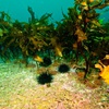
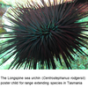
Dr Craig Sanderson from the Institute for Marine and Antarctic Studies (IMAS) in Hobart Tasmania discusses how longspine sea urchins are overgrazing Tasmanian rocky reefs: just one example of the impacts of ocean warming on marine ecosystems.